North Coyote Buttes, also known as “The Wave” is truly one of the most magical places I have ever visited. Each time we go, there are new wonders to explore. Everything from dinosaur tracks to incredible lace rock to intricately cut alcoves with sand dunes can be found here. This March, some of our canyoneering friends came to visit from out of state. Due to threatening weather, we took them to White Pockets and played the daily lottery from the top of the butte. Fortuitously, our friend Jess won the lottery, so we got to go for our fifth time and play tour guide.
Let’s start with the basics. The Wave is one of the most difficult permits to obtain in the United States. Only 64 people per day are allowed to visit, with thousands of entries to the lottery. There are two types of lotteries, daily and advance.
You can apply for the advance lottery four months in advance, from anywhere in the world. For example, in January you would be playing for a spot in May. You can select three different days during the month and play for each of those days independently. It costs $9.00 to play each time. Just for reference, it took my husband and me five years to get our first permit and we played almost every month. So if you play once and are disappointed that you don’t win, you might want to take a long-term perspective on this process.
If you are in the area (anywhere between Kanab, Utah and Page, Arizona), you can play the daily lottery, which is geofenced. To play, you must have a mobile device that is able to show your exact location, and a fairly decent signal. The lottery runs two days in advance and if you win, you need to come in person to the tourist office in Kanab to pick up your permit and watch a briefing video. The daily lottery gives out four permits each day, which is not a large number, but we have won twice using that method.
The Wave is a fairly strenuous hike of at least three miles each way to get to the main attraction. However, the permitted Wave area is huge, with so much to see, and our usual hike is nine to ten miles round trip. When planning your trip, it is important to take the weather into consideration. Winter, fall and spring are all great options as temperatures are tolerable. The summer months can get well over 90 or even 100 degrees, and there is no shade. As this is a long day, leaving early is a great option, but you still want to be able to see all the sights since this is a day pass and camping is not allowed. One other thing to be aware of is that the winter months have the lowest visitation rates and therefore the lowest competition for these scarce permits, so consider visiting during the off-season.
This hike has no shade and very little cell phone service. You want to be prepared, know where you are going, and bring plenty of food, water, a flashlight, sunblock and layers. During the winter and spring months, the weather is often unpredictable. In mid-March, during our last trip, we experienced hail, drizzle and very high winds all in one day.
One additional point to consider is that the hike starts at the Wire Pass Trailhead, which is about eight miles up the unpaved House Rock Valley Road. While the road itself is quite well graded and does not require a high clearance vehicle, it is made of bentonite mud and becomes impassable when wet. If there is a forecast for heavy rain or snow the day that you have a permit, you might want to make arrangements to camp in the parking lot overnight if the road is impassable when you get out.
I also want to point out that the Wave is extremely heavily patrolled and if you try to go without a permit, you will be caught. There is at least one ranger patrolling each day who has a list and stops everyone at some point during the day and checks permits. In addition, there are volunteers who take photos of all the cars in the parking lot along with their permits. If you didn’t win the lottery, consider two other amazing destinations in this area: South Coyote Buttes and White Pocket.
Now that we’ve taken care of the basics, let’s get to our tour of this amazing place. There is one most commonly taken “trail” that starts from the parking lot and continues over desert and sandstone. It is not super obvious in places, even though lately some cairns and markers have been put into place, so you will definitely want to download a track or have a map with you. There are excellent directions here, and a map of most of the most popular features here: Coyote Buttes North – Google My Maps.
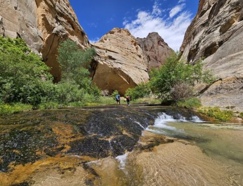
Over the years we have taken multiple paths to get to this area including the regular trail and “The Notch,” an unmaintained trail coming in on the south side of the permitted area which is much more difficult than the regular trail. Our current favorite is a loop that starts by going through Wire Pass and the excellent petroglyph panel there, returning up the pass.


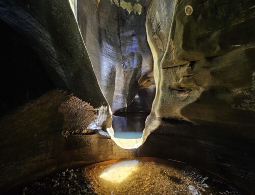
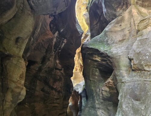
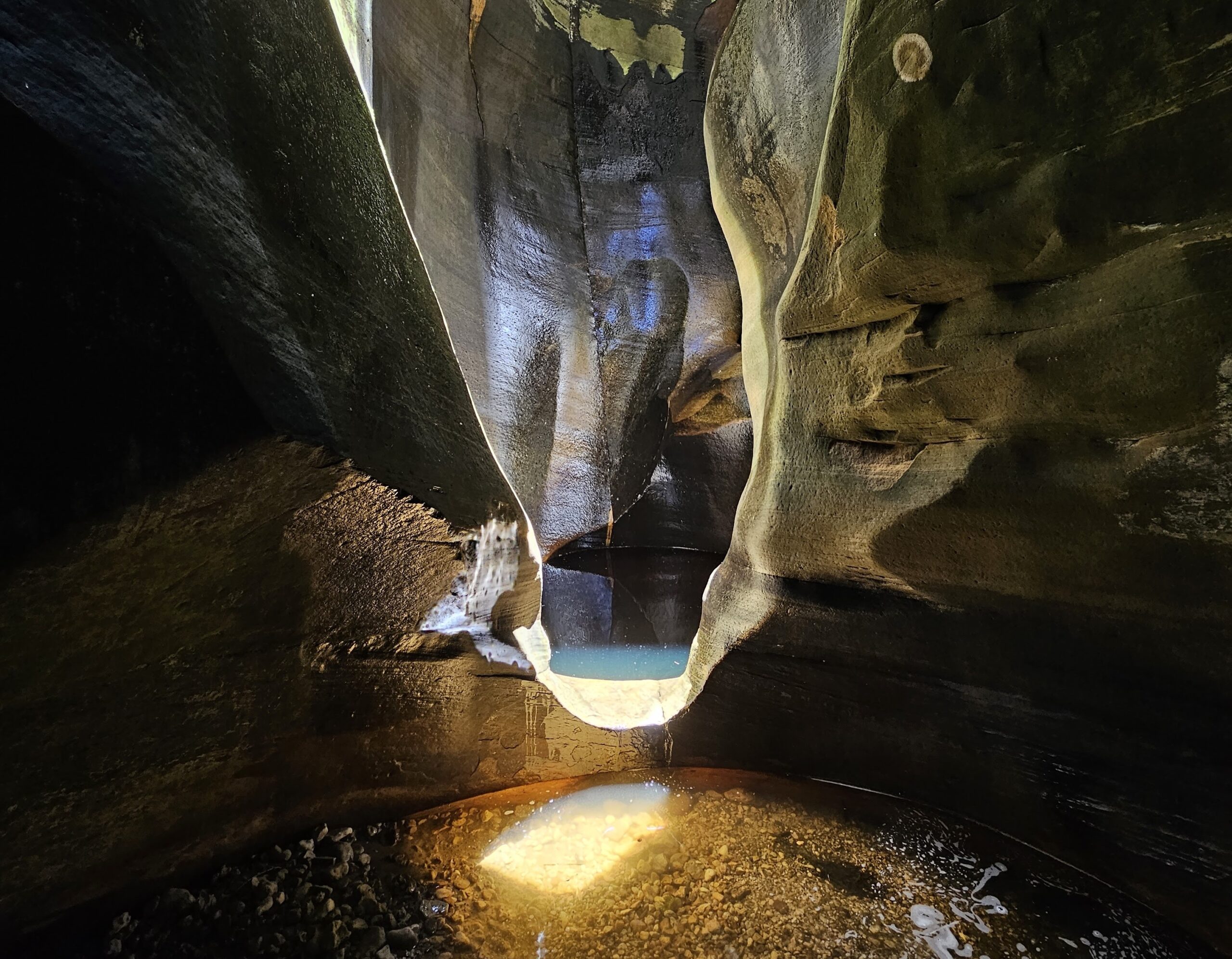
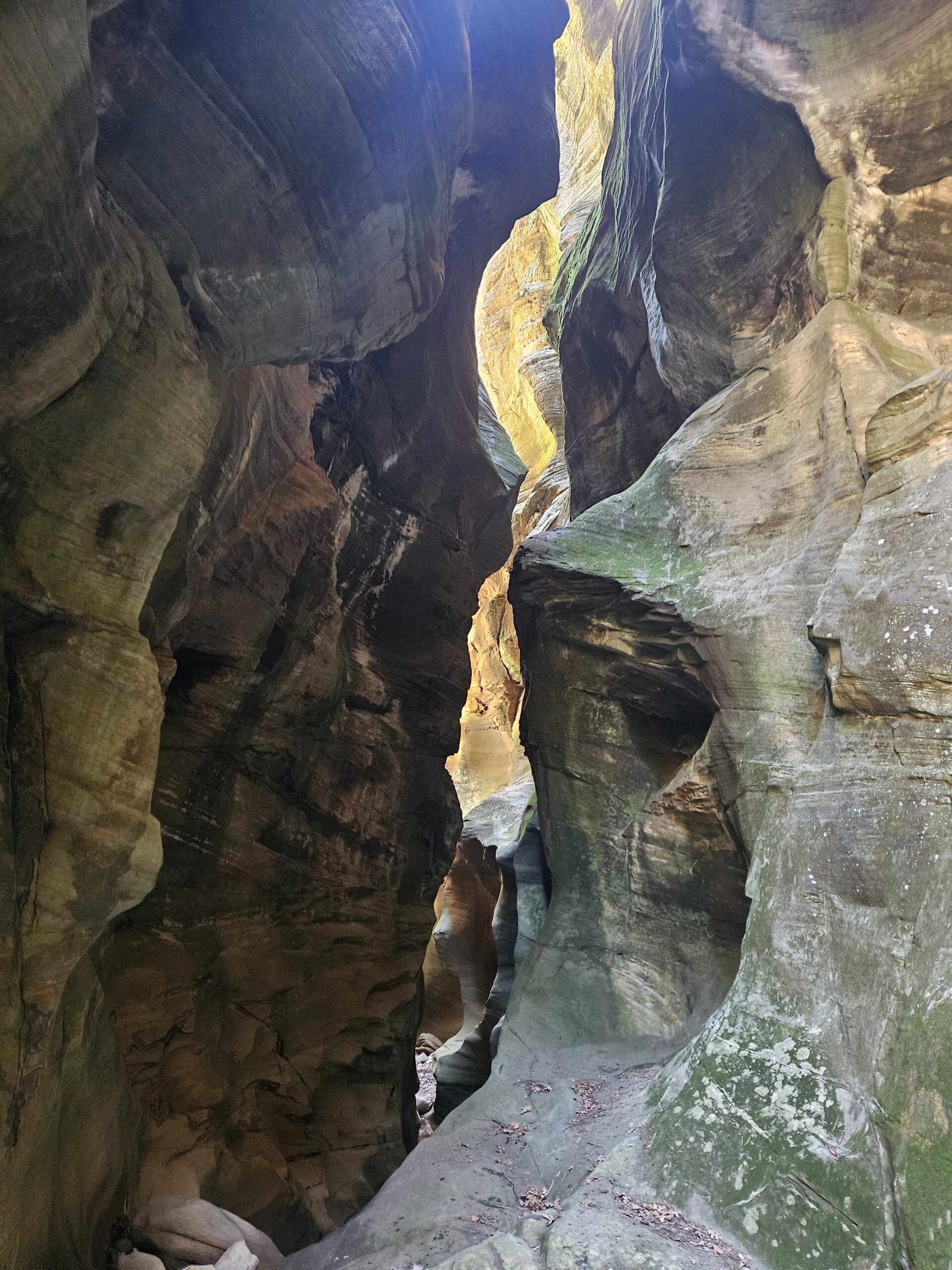
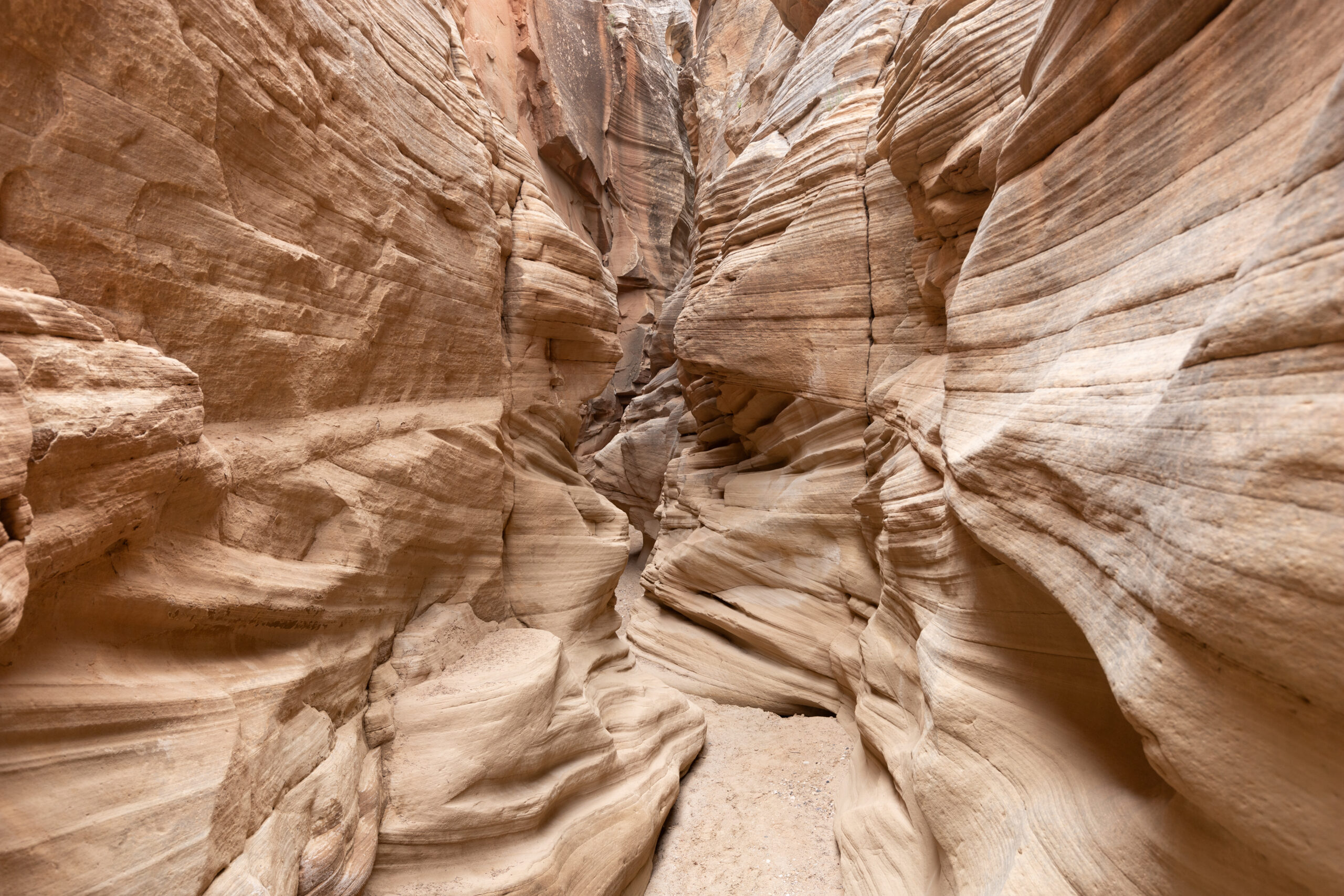
We then hike through the desert to a scenic slot canyon.


Then we continue to the Ginger Vortex and then the Wave itself.


The Wave is not our final destination, but we definitely took some time to wander through all the scenic and photogenic corridors and side slots. It also looks different during the morning and evening hours, so we considered returning in the afternoon to experience the various lighting conditions.


Our next stop is the formidable butte behind The Wave known as Top Rock. Walking around the butte takes you to a fairly steep but accessible climb up several layers of sandstone to the top. Winds are often gusting up here, so be sure to pack an extra layer. Almost at the top, you can take a short detour to see Top Rock Arch, which is the arch you see above The Wave. The views are spectacular. Come back the way you came, and continue south to “The Alcove”, which is a huge chamber containing a sand dune within a sand-carved sandstone alcove. You might experience the strong winds that carved this feature and get a free facial. The colors and textures of the sandstone walls are incredible, as is the view from the window to see the area from above.


Continue south along the top of Top Rock to Melody Arch, a double arch in a small depression. From the window here you can get a great view of the hamburger rock.


It’s time to return the way you came and begin the down climb to the bottom. If you ever feel that the sandstone is too steep, you can always sit down, place your feet firmly on the sandstone and slide down slowly to the next level. Zigzagging on fins that are not too steep is a great way to get down.

Once at the bottom, our next stop is the second wave, just to the south. This is a large area with beautiful undulating stripes that are much more textured than the wave and not as colorful.


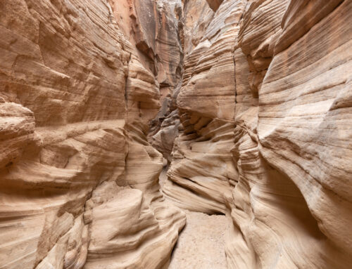
This is the furthest southern terminus of our explorations and at this point we begin our loop back to the main trail by heading due west down the sandstone ledges, losing quite a bit of elevation in the process. The goal is to circumvent a small slot canyon and then continue heading west along the edge of the sandstone towards the Boneyard.
The Boneyard is a large expanse of red and white ridged sandstone ledges with very unique lace carved boulders that look like giant artistic bones. They lie scattered on the surface, leading everyone to wonder how they were formed and where they came from. At this point we start heading north, doing a bit of tricky navigation to find the correct sandstone ledge that will allow us to proceed north without getting ledged out. There are quite a few lace rocks all along this ledge system.


Eventually, we descend off the sandstone ledges back to sand and shrubs and continue walking north until we find some excellent dinosaur tracks. There are multiple sizes of tracks that are very well preserved and quite photogenic.


As we continue heading northeast, there is one more surprise – a herd of bighorn sheep! We grab some photos and finally run into the official Wave trail that is marked by cairns, and cross into Utah from Arizona. There is a small gate on the official trail nearby. The official trail is more difficult to follow in areas where it crosses sandstone. However, once you exit the rock staircase and enter the sand stretch, the trail is obvious and easy to follow. The last part of the trail goes through a large and well-traveled wash that leads from Wire Pass to the parking lot. Finally, we return to our cars after a most memorable day.


What an incredible journey you had! Great photos and lots of good information – thank you!