This winter we are having some very unique weather conditions in southern Utah. It has been extremely dry but also very cold, resulting in any water remaining in the canyons being completely frozen, which has made some canyoneering routes unusually accessible for this time of year. A couple of weeks ago, we decided to descend Birch Hollow and explore Walker Gulch in an area adjacent to Zion NP. It was a freezing day, but an amazing experience to see these canyons during the winter!
Birch Hollow is one of the most beloved and heavily guided canyons near Zion. Being just outside the park boundary, it does not require a permit and commercial guiding is permitted. Beta can be found here: Birch Hollow – ropewiki. Birch was one of the first canyons that Max and I descended on our own when we were beginning our canyoneering journey. It was our eighth canyon, and I remember that June day in 2018 as if it were yesterday, ATCs and hollow blocks in hand, when we got our only rope stuck on the 100-foot rappel. Somehow, we were the only people in the canyon that day, which would be almost impossible these days. Max had just learned how to ascend a rope, and it was truly a testament to his abilities that he managed to reascend back up the 100-foot wall when it really mattered. I was grasping the Garmin and waving it around wildly while trying to get a signal, ready to call SAR. This all brings an embarrassed smile to my face today.
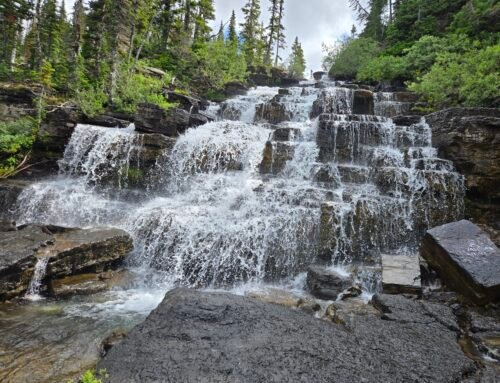
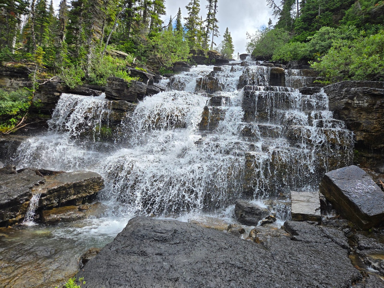
We have been back to Birch Hollow several times since we moved to Kanab, and it’s usually an enjoyable half day jaunt, at least when you don’t have to wait for a large tour group ahead of you to descend that 100-foot rappel. The approach starts at a trailhead and follows a well-worn trail down a wash. About half-way through the hike, there is a dramatic cliff, plummeting several hundred feet down. There is a choice here to take a very steep and eroded trail down to the bottom of the cliff or to do a 70-foot rappel off a tree and walk down a scree-strewn slope. It’s honestly not much of a choice because the trail is horrible and we much prefer to rappel down. As we continue the hike down-canyon, the walls get taller, and the geology gets more interesting. Right before the technical section starts, there is a layer of gypsum, coating the walls and floor in white, with beautiful white rocks strewn all about.


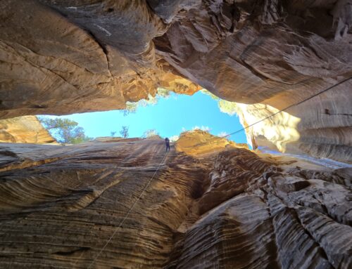
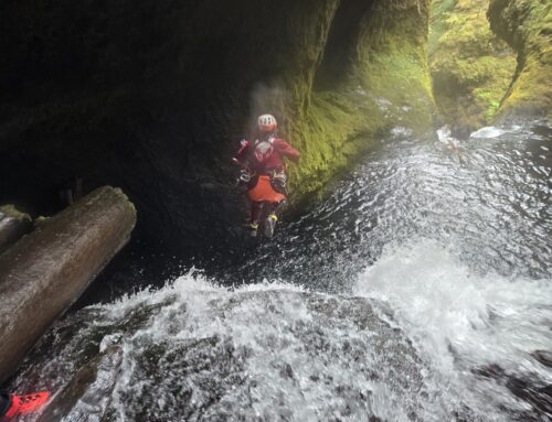
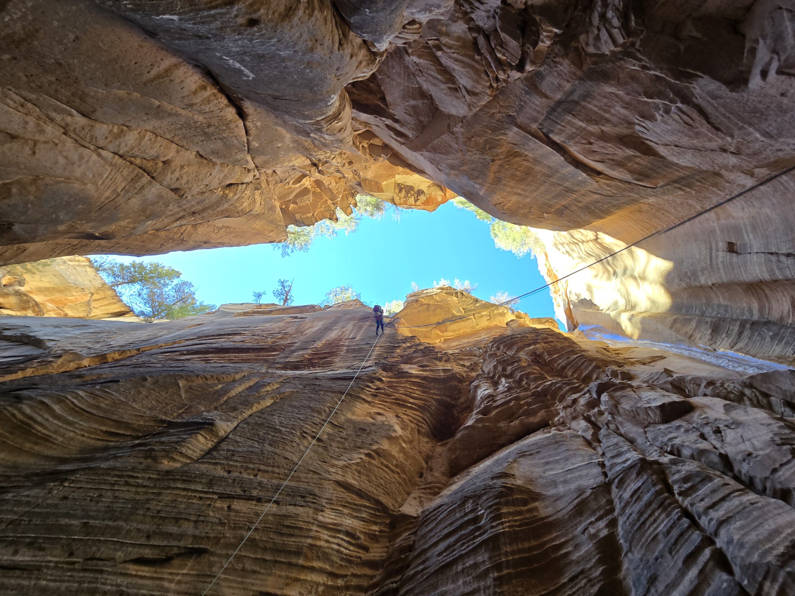
The next rappel is quite unique, descending from a sharp overhang that ends in a hollowed-out bowl. From below, the rocks are quite striking with a white band on top and a red layer that starts half-way through the rappel. Once the technical section begins, the canyon changes character and turns into a gorgeous series of sculpted narrows and curving walls and chutes. The top section is a series of downclimbs and short rappels off chockstones. Suddenly, the canyon opens up and you see wide vistas of Zion, along with a sculpted dry fall plunging 100 feet down into the earth. This is the infamous rope-eating rappel of our canyoneering youth, with rope grooves growing ever deeper. From here, there are four more rappels one right after the other, descending into a beautiful cathedral-like chamber with a giant chockstone for a roof and polished fluted chutes descending to the confluence with Orderville Canyon.


")


If you were to follow Orderville for another five miles or so, you would find yourself in the Zion Narrows and be able to exit out via the Riverwalk trail, which is a beautiful route in warmer months. Be aware that exiting through the Narrows requires an Orderville permit. At this time of the year, Orderville is magnificently frozen over. This was a surprise to us because during the warmer months, the upper part of Orderville is usually dry. It seems that there are natural springs that evaporate during the summer, but seep down the canyon and freeze over during the winter, forming a layered ice river that extends the entire length of the canyon.


We headed upcanyon and climbed to the top of a dryfall where a 4-wheel-drive parking lot can be used as a shuttle out. The road heading down to this lot is very rough and requires high clearance. As we only had one capable car that day, that was unfortunately not an option. Our next target was Walker Gulch, whose approach would take us another couple of miles northeast of the parking lot. This tale is to be continued in a further post.
